 Location: Lake City, Florida (North Florida)
Location: Lake City, Florida (North Florida)
General Information:
Zoning: Classification: CI, Commercial Intensive (Commercial-Retail Use)
Type: Hotel/Motel Facility
Year built: 1983
Renovations: Phase 1: 2000, Phase 2: 2005. Current property is fully renovated and rooms in like-new condition.
Description of Property:

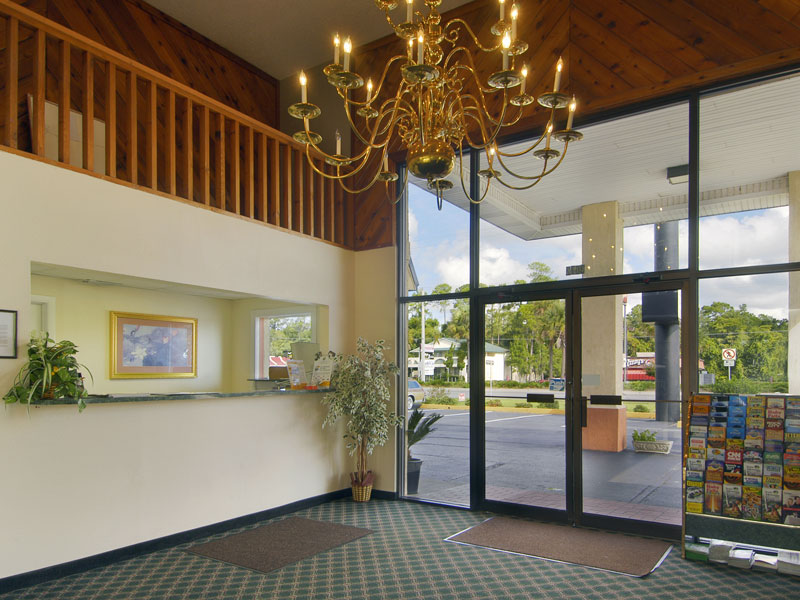
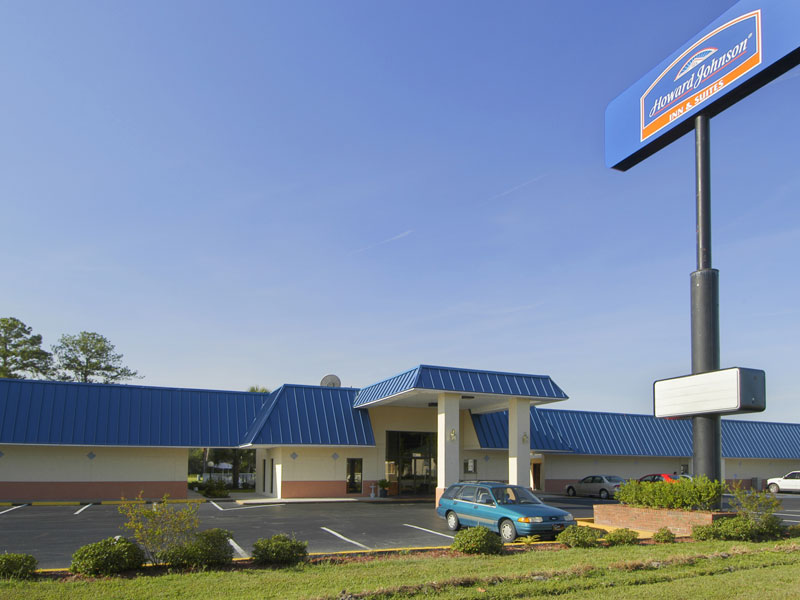
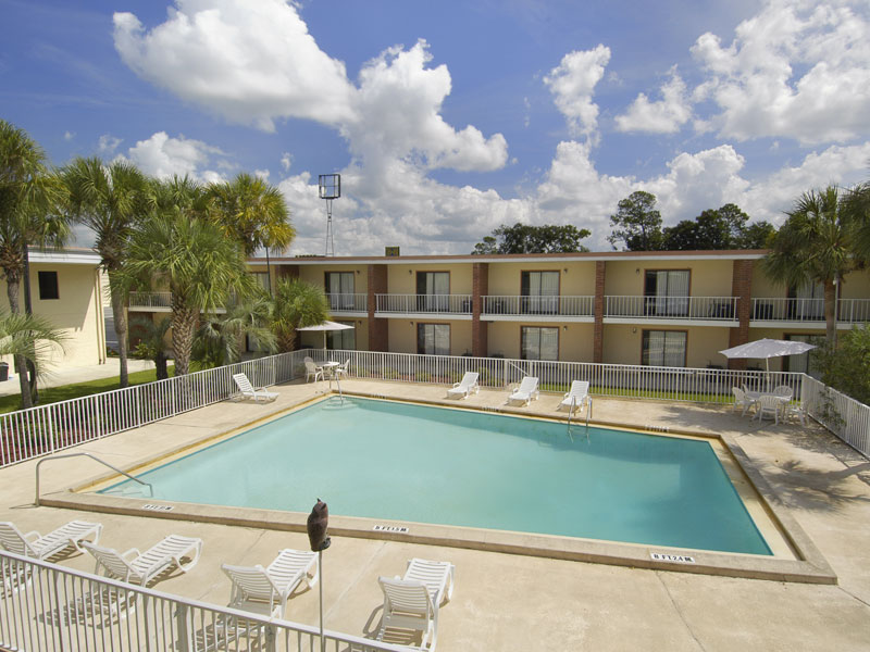
Howard Johnson
69 Unit Hotel and Suites property. This is offered as a hotel/motel for sale or commercial property for sale
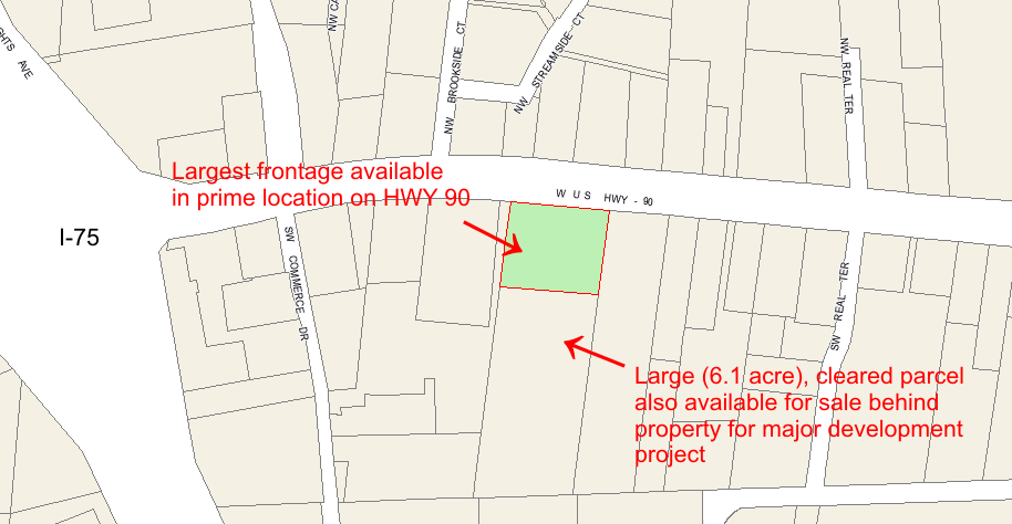
in a high-demand market. The large parcel with over 360 feet of frontage would
make an excellent traffic/land-exposure purchase.
Geographical Specifics: High thru-traffic area due to I-10 and I-75 junction. Excellent piece of Florida real estate. The property is located along the south side of US Highway 90 West, approximately 1,500 feet east of Interstate 75, within the main development area of the city of Lake City, Columbia County, Florida. This commercial property has a sites address of 3072 US Highway 90 West, Lake City, Florida 32055.
Major Highway Frontage: 360 feet along Hwy 90, just 1/4 mile off exit. Largest frontage lot available on Highway 90 in its location.
Commercial Land/Multi-use property:
With major traffic and interstate proximity, as well as high growth in the area... this is a HIGHLY visible and desired parcel.
Land plot size and shape is very adaptable to development of multiple restaurants on site, as well as suitable for shopping complex, condo conversion, and other commercial uses that can benefit from one of the LARGEST available frontages on the busiest section of HWY 90 for Lake City.
Over 6.1 acres of undeveloped and PRE-CLEARED land is also available behind the property for larger development needs!
Click here to see GIS PLOT MAP OF PARCEL
Area:
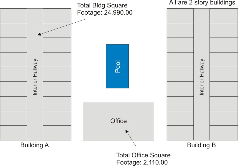
Total Parcel Acreage: 111,514 square feet, 2.56 total acres
Total Enclosed Square Footage: 52,090.00 sq ft
Building to Land Percentage: 46.71%
|
CONTACT INFORMATION:
D Mehta |
|
SAVE $$$'s... listed here for independent sale
Serious brokers welcome, please email or call for more information |
Property Images:

Site Analysis: Photos:

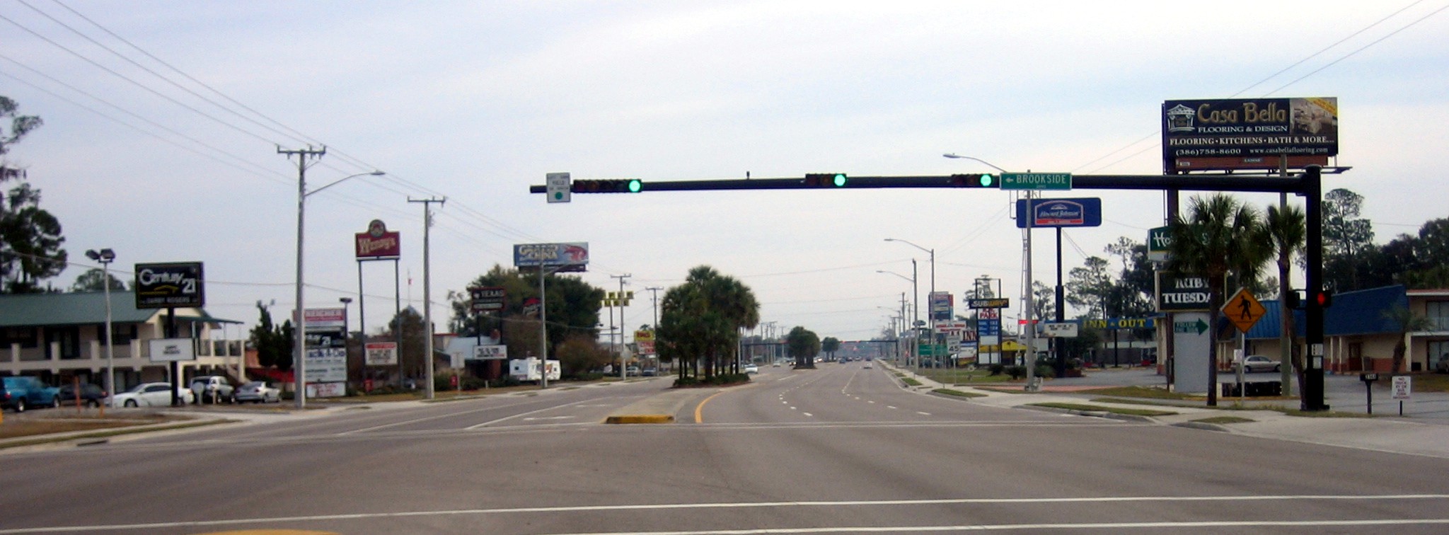
1. Westbound view on HWY 90 (property on left)
2. Eastbound view on HWY 90 (property on right)
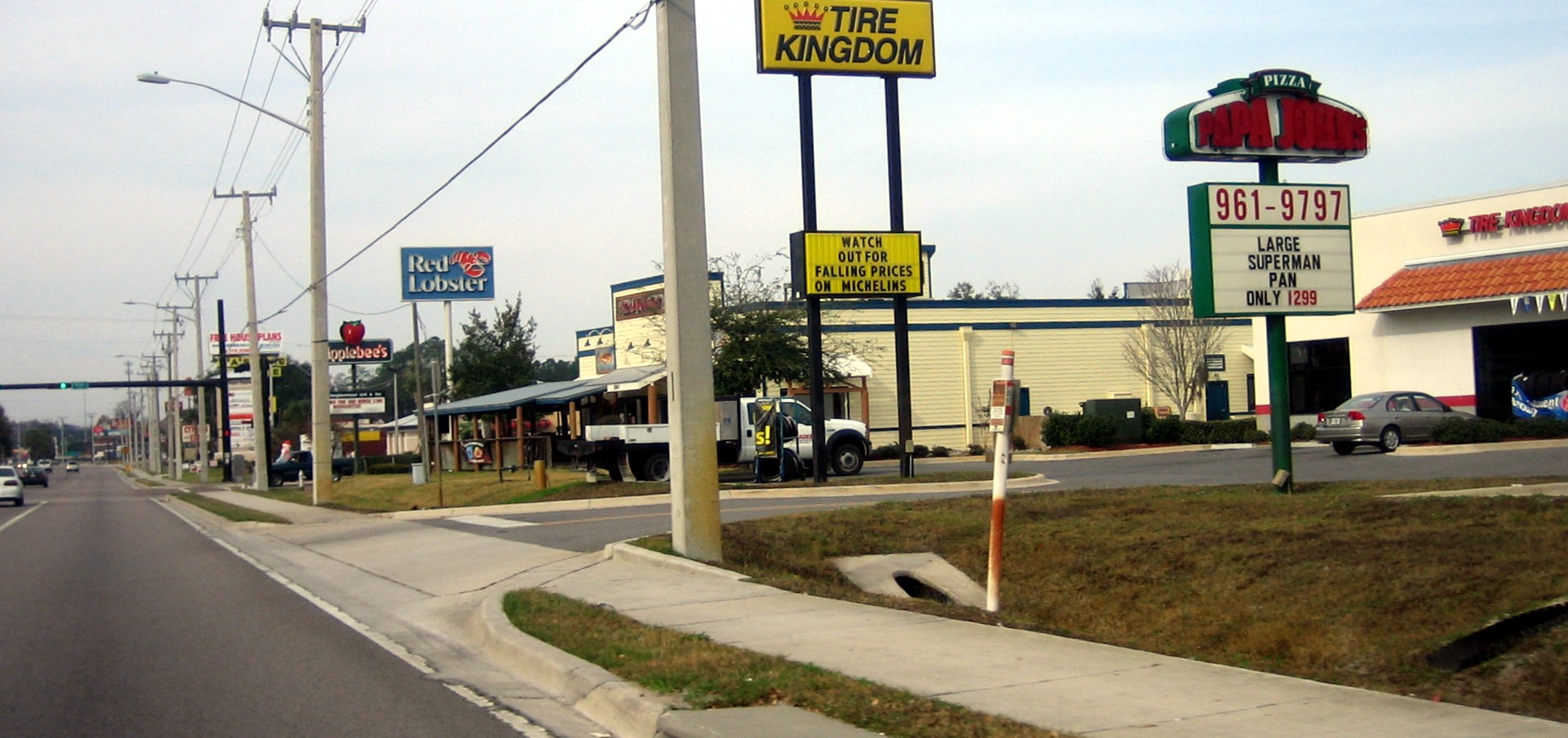
3. Largest dining/restaurant development area within 50+ miles


4. Shopping within 1/4 mile at Super Wal-Mart
5. Shopping within 1/4 mile at Lake City (Gleason) Mall
Site Analysis: Physical Characteristics:
Plot Size: Approximately rectangle being 360.01 feet on the north, 360.00 feet on the south, 310.00 feet on the east, and 309.66 feet on the west.
Area: 111,514 square feet, or approximately 2.56 acres
Topography: The subject parcel (commercial land property) is relatively level and lies at the grade of the adjacent roadway, US Highway 90 West.
Vegetation: The subject property is currently completely cleared and improved with a three building, 69 room, all suite, motel facility. Those areas not covered by the subject building are improved with several grassed and landscaped areas located on all sides of the subject buildings, as well as between the buildings and surrounding the guest swimming pool.
Soil Conditions: The site is presumed to have an adequate load-bearing capacity for development purposes, as evidenced by the current building improvements. Also, no surface or subsurface hazardous materials or other contaminants are presumed on or in the site. However, engineering test borings were not performed by the appraiser and no warranties are given by the appraiser concerning engineering of the site.
Census Tract: The subject is located within census tract number 9905.
Flood Map Classification: Map Number 120070 0175 B, dated 1/6/88, Zone X, a designated non-flood hazardous area. A copy of the flood map is attached here.
Drainage: The site is presumed to have adequate drainage and percolation under normal conditions. At the time of inspection, the subject property appeared to contain adequate natural drainage. Surface runoff travels mainly to the rear of the site and into several low and wet areas located off site to the south.
Access: US HIGHWAY 90 WEST: Three asphalt paved traffic lanes on each side of a concrete and landscaped median, sidewalks, and streetlights. No direct access is available to the site from westbound traffic lanes.
Utilities and Public Services: The reported utilities and public services available to the subject property include the following: public water, sanitary sewer, garbage collection, police protection, fire protection, natural gas, electricity, and telephone.
Previous Appraisal Resources: Please note all resources referenced below were completed on 1/29/2001
Area Location Map
Neighborhood Location Map
Plat Map
Subject Sketch
Flood Map
Location Maps: All maps and images provided by Google Maps

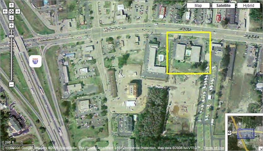
Excellent proximity to Interstate traffic (less than a 1/4 mile from I-75)

Excellent proximity to Interstate traffic (less than a 1/4 mile from I-75) - Satellite Hybrid View
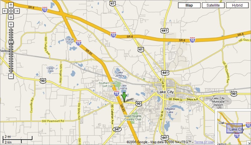
Intersection of I-75 and I-10 produces a large amount of traffic. Lake City is largest city in a 50-mile radius to this interection.

Zoomed out state-wide view
Older satellite image (approx 2+ yrs old image) of property in relation to I-75
Legal Description: The property's legal description, as recorded in Columbia County Public Records, is as follows:
TOWNSHIP 3 SOUTH, RANGE 16 EAST
Section 35: Commencing at a point which is the Southeast Corner of Lot 9 of "Lake Harris Farms" as per plat thereof recorded in Plat Book 4, Page 21 of the public records of Columbia County, Florida, said point being N 87° 55'17" E 868.20 feet from the Southwest Corner of the SW 1/4 of the SE 1/4 of Section 35,
Township 3 South, Range 16 East; thence continue N 7° 03'47" E along the East boundary of sid Lot 9, 718.40 feet for the POINT OF BEGINNING; thence continue N 7° 03'47" E along East boundary 310.00 feet to the South right-of-way line of State Road No. 10 (US Highway No. 90) said point being 87.00 feet from and at right angle to the survey center line of said State Road; then N 84° 41'43" W along said South right-of-way line 312.61 feet to the point of curvature of a right-of-way line curve being concave Southwesterly and having a radius of 3,276.57 feet; thence Northwesterly along said South right-of-way line curve, a chord bearing a distance of N 35° 06'25" W 47.40 feet; thence South 7° 03'47" W parallel to the East boundary of said Lot 9 309.66 feet; thence S 84° 41'43" E 360.00 feet to the POINT OF BEGINNING.
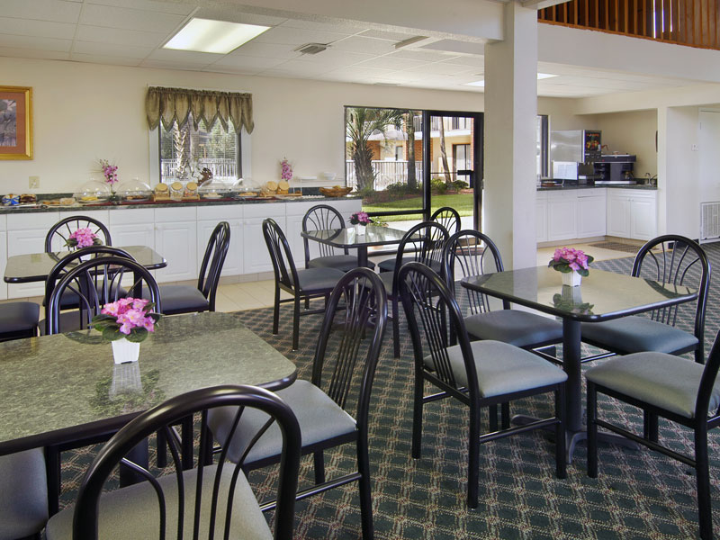
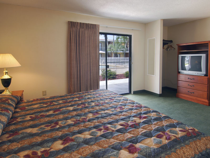
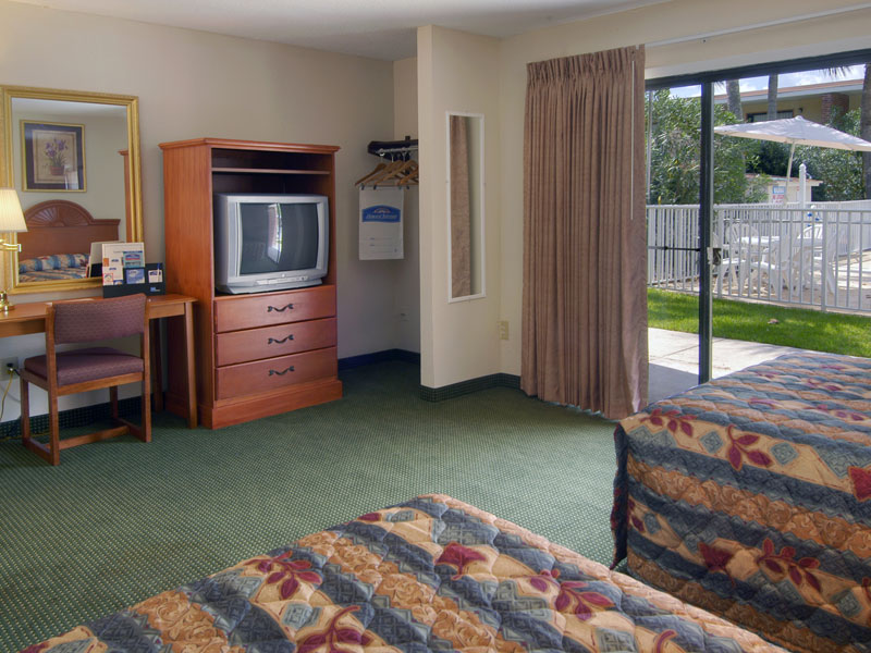
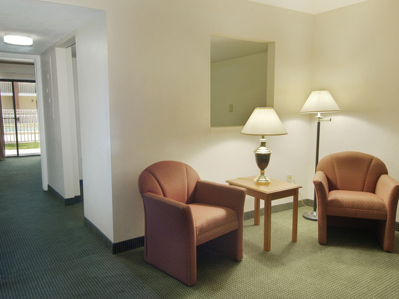
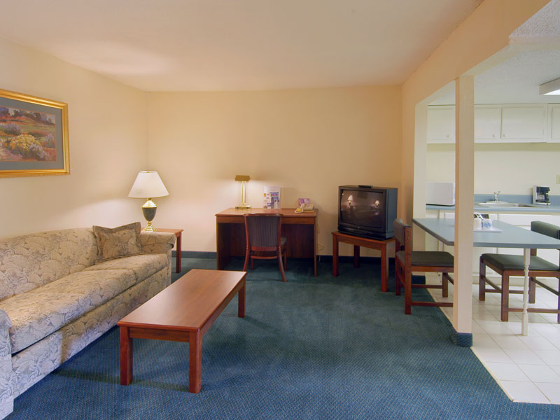
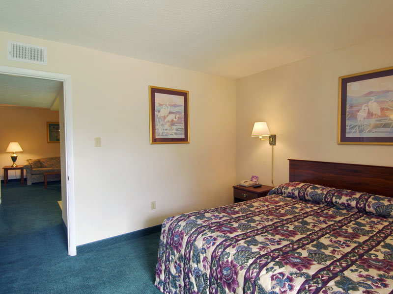
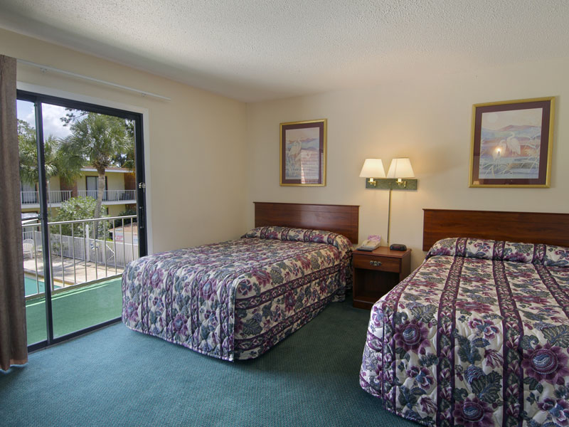
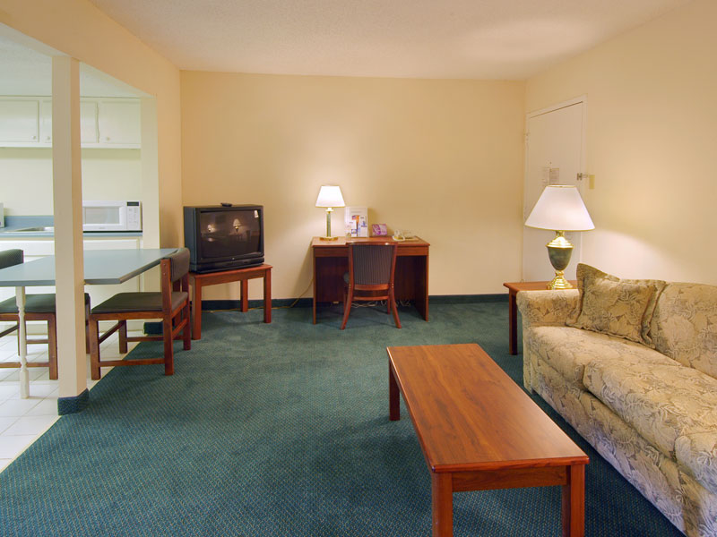
Hotel Amenities:
Appraisal Resource: EXPOSURE TIME (note: the following is taken from a 2001 appraisal, information may be out-of-date)
The reasonable exposure time inherent in the market value concept is always presumed to precede the effective date of the appraisal. Exposure time is different for various types of real estate and under various market conditions. Relative to exposure time, the definition states: 'The estimated length of time the property interest being appraised would have to be offered on the market prior to the hypothetical consummation of a sale at market value on the effective date of the appraisal; a retrospective estimate based upon an analysis of past events assuming a competitive and open market".
Favorable factors affecting the exposure time of the subject property include the property's favorable location within the main development area of Lake City, as well as its location along Lake City's primary east-west thoroughfare, US Highway 90. The subject property also benefits from exposure near Interstate Highway 75, one of the country's most heavily traveled north-south interstate highways and the primary ingress/egress route for tourist traffic to the State of Florida. This area of Columbia County is currently experiencing rapid growth and expansion, and hotel facilities, such as the subject, are in relatively high demand. Also, several new motel facilities have recently been completed along Commerce Boulevard, south of US Highway 90 and across Interstate Highway 75 along Florida Gateway Boulevard. The Area and Neighborhood Analysis sections of this report further illustrate the economic conditions within the area of the subject property.
Based on the above analysis, an exposure time of six months appears reasonable and reflective of current market conditions.
Appraisal Resource: AREA ANALYSIS (note: the following is taken from a 2001 appraisal, information may be out-of-date)
The property appraised is located in the north-central section of Florida in Columbia County, near the main development area of Lake City, the county seat. Jacksonville lies approximately 60 miles to the east and Gainesville is located approximately 45 miles south.
Columbia County contains 797 square miles. Among the county's natural resources are the Osceola National Forest, the bordering Suwannee River, and the Ichetucknee River that provides nearly three miles of swimming, tubing, and canoeing.
The Columbia County 1999 population was estimated at 57,226, and the projected population for the year 2005 is 64,910 representing a 13.42% (or 2.24% per year) increase, while the projected population for the year 2015 is 76,399, representing a 33.50% increase (or 2.09% per year). The Columbia County population increased 34% between 1990 and 1999. The city of Lake City had an estimated 1999 population of 15,000.
There is a relatively equal distribution of population among the various age groups with the greatest percentage in the 25-44 year-old age bracket (28.30%). The remaining age brackets are ranked as follows: 45-64 (22.50%), 0-14 (21.29%), 15-24 (14.55%), and 65+ (13.35%). The median age as of 1/1/1997 was 35.2 years.
The 1999 county population density is 71.80 persons per square mile (797 square miles) with the majority of the population centered in and around the area's incorporated cities.
In addition to general population growth, per capita personal income has grown and is expected to continue to grow (Source, Florida Trend Magazine 1997 Economic Yearbook). The most recent study revealed a per capita personal income of $16,600, and a median household income of $24,022.
In Columbia County, the largest employer is the Columbia County School System with approximately 1,159 employees. The VA Medical Center is the second largest with 963, followed by the TIMCO Corporation (765), Homes of Merit (650), Department of Transportation (590), Columbia Correctional Center (449), PCS Phosphate (375), Lake City Medical Center (309), and Anderson Columbia Company (302).
Columbia County has a labor drawing area with an approximate radius of 30 miles, and an estimated available labor force of 55,000. In Columbia County alone, the labor force is estimated at 24,188.
Regarding unemployment rates, Columbia County's percentage is equal to the statewide percentage while Florida is slightly higher than the national average. The county's unemployment rate in February 2000 was reported to be approximately 4.3 percent, compared to the statewide rate of 3.7 percent.
Rail services are provided to the area by the CSX Transportation Company and by Norfolk-Southern. Railroads provide an important function for many industries of the area, especially those in forestry related businesses and phosphate mining. Additional transportation services are provided by bus lines, various trucking companies, and numerous overnight parcel delivery companies. Columbia County contains the Lake City Municipal Airport with a runway length of 8,000 feet. The Jacksonville International Airport is located approximately 60 miles to the east of Lake City, and the Gainesville Airport is 45 miles to the south.
The area is fortunate to be served by numerous major road networks: Interstate Highways 75 and 10, US Highways 90, 41, and 441, and State Roads 25, 47, 100, and 247; and various connecting roads. The roadways provide good access between locations and traffic congestion has been increasing in the recent past due to the increase in commercial business and population growth in the area. In order to offset these current and potential traffic problems, US Highway 90, from County Road 247 to Interstate Highway 75, has recently undergone a major widening and resurfacing. The project increased the size of the thoroughfare from four to six lanes, and includes a center turn lane and concrete and landscaped medians. The project also incorporated the implementation of an improved drainage system and new traffic signals.
Plans are currently being finalized for construction of a new bypass road which will divert traffic from US Highway 90, currently the area's most heavily traveled east-west thoroughfare. The project, currently named the Western Bypass, will have its origin at Douglass Road and US Highway 90 West just west of the Gleason Mall and in the main development area of Lake City. From this point, the Western Bypass will carry traffic north-northeast past the Lowes Home Center and toward Lake Jeffrey where it will cross County Road 250 (Lake Jeffrey Road) and connect with the Norris Bascom Bypass. It will then continue east as Norris Bascom until its northern terminus at US Highway 41. To the south from US Highway 90 West, the bypass will continue in a southeasterly fashion through the existing Columbia County fairgrounds property until connecting with Old Troy Road. It will then continue past the eastern terminus of Old Troy Road and through the northern portion of the Quail Heights subdivision where it will cross County Road 341 (Sisters Welcome Road) and connect with Marvin Burnett Road. Marvin Burnett Road then continues east to its terminus at State Road 47. This project should serve to alleviate traffic congestion problems along the county's current major arterials and will provide direct access to developing residential areas north and south of town.
Most major roads are in good condition. The various governments appear to have followed adequate maintenance programs. Parking may only be a problem in the downtown business district but as a rule, plenty of parking spaces are available. Parking at most other locations is generally adequate.
Retail growth has been a major force in the economic upswing of Columbia County. In the past ten years, the county has seen the addition of a Wal-Mart Superstore, Red Lobster, Applebee's, Fazoli's, Texas Roadhouse, Lowes Home Center, and RJ Gators. All of this new construction has taken place in the vicinity of US Highway 90 and Interstate Highway 75. In addition to retail growth, the county has also seen the addition of new Chevrolet, Mazda, and Chrysler/Plymouth/Dodge dealerships; the $33 million dollar Lake City Medical Center; and a Jameson Inn and Microtel Motel in the area.
Within the past six months, an increase in development has been experienced within the main development area of Lake City. Gleason Mall, the area's only enclosed shopping mall has recently completed the first phase of a major renovation and expansion which will provide a new retail space to an existing anchor tenant and will bring in a new anchor tenant. Also, the management of the mall has recently procured two new interior tenants, a shoe store and music and book store. The construction on Gleason Mall will also include a full renovation and is expected to be completed within the spring of 2001. Across US Highway 90 from the mall, a new Office Max store has recently been completed in a new shopping plaza named Gleason Place. The Office Max occupies roughly half the site area leaving room for future development. Further east on US Highway 90, a stand-alone Eckerd's store and Kentucky Fried Chicken recently opened, and a new Crystal franchise recently opened across from the aforementioned Gleason Place. Projects currently under construction or planned for the near future in the area include a 320 unit luxury apartment complex, a Harley Davidson dealership, a new Ford/Lincoln/ Mercury dealership, a Country Inn and Suites hotel, and six acre Travel Country RV sales and service center (recently opened).
At the intersection of US Highway 90 and State Road 247, construction is nearing completion on a Walgreen's drug store.
The city and county have also seen a rash of residential development within the past five years. Several residential subdivisions are currently selling lots and, according to local market participants, an increase of lot sales and building activity has been experienced. In 1999 alone, 16 new subdivisions were recorded in Columbia County, including Laurel Lakes, Cypress Landings, and Hills of Windsor (an affluent gated community marketing lots restricted to construction of homes 3,500 square feet and larger). In 1998, 221 single family homes were constructed in the area. In early 2000, construction began on two new phases of one of the most active subdivisions in Lake City, the Plantations, located on the north side of US Highway 90, just west of Interstate Highway 75.
Commercial office subdivisions have also seen increases in sales and development over the past several years. South Bank Place, the North Florida Professional Park, and the Plantations commercial subdivisions have all experienced good absorption rates over the past five years, with South Bank Place being 100% developed. North Florida Professional Park is approximately 67% developed (4 of 6 lots taken down), while the Plantations commercial subdivision is the newest of the existing parks and has been approximately 76% developed (13 of 17 lots sold) since selling its first lot in August 1997. In addition to these developments, two new office subdivisions have recently completed the infrastructure phases of development. Stonegate Park is located on the south side of US Highway 90, directly across the street from the Plantations, just west of Interstate Highway 75 and will market 19 individual lots. Marion Place, is located in the northeastern quadrant of the intersection of US Highway 41 and Malone Street in southern Lake City. This project will be developed in conjunction with a proposed adjacent residential development and will market 15, 1/2 acre lots. As of May 10, 2000, six commercial lots in this development have sold.
The Columbia County Courthouse is in the midst of a full scale renovation and addition. Upon completion of this first phase of the project, one of the two remaining phases will begin. These phases will include the renovation of the courthouse annex which currently houses the planning and zoning department, property appraiser's office, and tax collector's office; as well as the renovation of the original portion of the main courthouse. The Supervisor of Elections building and adjacent office building was recently razed in order for the county to extend Olustee Park, the original town square, back to its original size which extended south to US Highway 90.
The Columbia County Board of County Commissioners recently approved an incentives package that will bring a computer call center operated by Service Zone to the area. This facility will handle phone calls from customers with questions regarding computer equipment and/or credit card accounts.
Other growth indicators include a new high school in Fort White, and a new elementary school southwest of Lake City on the west side of State Road 247 near Troy Road.
The area has a typical balance (compared to similar rural communities) of industrial centers, commercial districts, residential neighborhoods, apartments, churches, schools, universities, medical facilities, and park areas. Columbia County and Lake City still has substantial land for development, particularly in the outlying county areas. Remaining growth and redevelopment of older properties are occurring at mixed rates. Other parts of the county that are less built up are growing at stable rates.
Columbia County contains two hospitals with 203 total beds, two emergency centers, the VA Medical Center with 140 beds, one VA nursing home with 210 beds, three private nursing homes with 275 beds, approximately 45 doctors, 22 dentists, and 6 optometrists. The new Lake City Medical Center hospital has recently been completed and opened for operation in the northeast quadrant of Interstate Highway 75 and US Highway 90. This facility is expected to serve a larger population base, as well as provide medical services previously unavailable in the Lake City/Columbia County area.
Building permits for 1999 in Columbia County reflected a total value of $32,635,373.
The county added $139,764,067 in new construction to the tax rolls in 1999, 221 single family homes were constructed in 1998, and 16 new subdivisions were recorded in 1999.
Local governments are run by both elected and appointed officials. Both spending and taxation are reviewed annually. The current level of assessments and taxes is well within the reasonable guidelines established by the state. Homestead exemption of $25,000 is available for permanent residents and up to a 4 percent discount is available for early payment of taxes. A big drawing power to the state and area is that there are still no state or local personal income taxes.
Services provided by local governments include public water and sewer, police and fire protection, zoning and building regulations, and other administration. Trash collection is divided between city governments and private contractors.
Other utilities of the area include: electricity from Florida Power and Light Company, Florida Power Corporation, Suwannee Electric Cooperative, and Clay Electric Cooperative; telephone service from Southern Bell and Alltel; and piped natural gas from Lake City (distributor), and the Florida Gas Transmission Company (supplier). Most neighborhoods have adequate utilities and public services, however, the more outlying areas have inferior utilities and public services and use private wells and septic systems.
These and other statistics indicate a continuance of variable population and income growth, and a good base for reasonable demand in most sectors of the real estate market.
There appears to be adequate housing, existing and under construction, to serve the foreseeable residential needs of the area. The average household size is between 2 and 3 persons. In addition to supply and demand, residential interest rates have a substantial effect on both residential buying and construction. Current residential interest rates are favorable and are creating conditions which allow for development and refinancing.
In conclusion, the long-term outlook appears to be continued growth of population, employment, and income. Property values and demand are expected to exhibit mixed trends as the various market factors interact. Different areas will be growing at different rates depending on availability of land, supply and demand, and other factors.
The general area is considered to provide a diversified supportive economic base for most properties over the long term.
Appraisal Resource: NEIGHBORHOOD ANALYSIS (note: the following is taken from a 2001 appraisal, information may be out-of-date)
The property appraised is located on the south side of US Highway 90, approximately 1,500 feet east of Interstate 75, in the main commercial district of Lake City, Columbia County, Florida. The property has a situs address of 4500 US Highway 90 West, Lake City, Florida 32055.
US Highway 90 is one of the primary and most heavily traveled thoroughfares in Lake City. This highway extends east through Lake City and intersects Interstate 10 which carries traffic to Jacksonville. US Highway 90 extends west to Live Oak, approximately 25 miles, and further points west. This highway is used extensively by residents commuting between Lake City and Live Oak to the west, and is also an important ingress/egress route to Interstate 75.
The subject neighborhood is considered to include those properties having frontage on West Highway 90 between Interstate 75 to the west, and County Road 247 to the east. Compatibility of land use patterns, and an area within which similar properties are subject to similar influences on value are the reasons for this delineation.
For the vicinity surrounding the subject neighborhood, commercial businesses are generally located at major intersections and along the major thoroughfares including State Road 10A (Baya Avenue), US Highway 41, and US Highway 441. The neighborhoods surrounding these thoroughfares primarily contain single family residential subdivisions and other residential developments. Overall, the area has a reasonable compatibility among uses, adequate access, utilities and public services, and a reasonable conformity between zoning and land use designations. Personal observation indicates that the overall area is between 75 and 80 percent built-up.
The subject neighborhood is developed with a variety of commercial-retail and office improvements including dine-in restaurants, new and used car dealerships, shopping centers, motels, service stations, auto repair and service businesses, and other retail buildings. The immediate neighborhood of the subject property near Interstate 75 has seen extensive development over the past five years and is expected to see continued growth as population continues to rise and demand for service related facilities increases. The proximity to Interstate 75 is considered a positive influence on this development. The recent development in the immediate area of the subject property has favorably influenced the subject neighborhood and is expected to favorably affect the subject neighborhood over the long term. Overall development, conformity, and land use appears adequately balanced and stable. Buildings vary in size and type of construction but are generally of good quality construction and appear in good condition.
Directly to the north of the subject property and across US Highway 90 is Brookside Drive which runs north and serves a small residential area. On both sides of Brookside Drive are a variety of commercial and retail type improvements including (moving west to east from the intersection of Commerce Boulevard and US 90) an Exxon filling station, a Sonny's Barbeque restaurant, a McDonald's restaurant, a two-story strip retail facility known as Veranda Shoppes, and a Wendy's restaurant. Directly to the west of the subject property is a Days Inn motel facility, while directly east of the subject is a service station, convenience store, and campground. To the south of the subject is vacant land. Further west is a BP filling station, a vacant Dairy Queen building, and a Burger King restaurant. To the southwest of the subject is Commerce Boulevard. This is an area which is rapidly being developed with a variety of motel facilities including a Rodeway Inn, a Jameson Inn, and a Microtel Motel. Also in this area is a Cracker Barrel restaurant and a neighborhood shopping center known as Westfield Square. All of the properties directly surrounding the subject property benefit from their exposure near and along the eastern side of Interstate Highway 75.
No factors of external obsolescence or evidence of an overbuilt market were observed in the neighborhood. Few vacant buildings are noted
The subject neighborhood has all the characteristics necessary to support the subject property.
In most cases, properties are purchased using mortgage financing rather than buyers paying cash. Primary financing sources include sellers, with purchase money mortgages, and financial institutions, with third party conventional loans. Terms vary widely relative to interest rates (fixed vs. variable), loan-to-value ratios, amortization periods, timing of payments, and balloon dates. Current interest rates are in the range of 8.0 to 10.0 percent per annum.
The supply and demand of comparable properties to the subject appear in-balance in Lake City and there does not appear to be excess competition. No vacant motel facilities were noted along this section of West Highway 90. Market conditions are favorable to maintain rent levels, occupancies, and expenses.
The subject neighborhood should see continued development as Columbia County and surrounding counties grow. Although population growth is at a moderate rate, increases are expected as south Florida residents relocate to more rural areas of Florida to escape over-crowded conditions and associated social problems. Property values are at least expected to moderately rise based on past growth trends experienced in the area, as well as forecasted continued growth.
In summary, the subject property has good access and exposure for its retail use. The surrounding neighborhood has reasonable compatibility within itself and with the subject, and has no apparent adverse influences for the subject property under highest and best use. Supply and demand appear to be in reasonable balance. Overall, the neighborhood is considered to provide good supporting characteristics for utilizing the subject property under its present and highest and best use.
Appraisal Resource: Zoning and Land Use Plan (note: the following is taken from a 2001 appraisal, information may be out-of-date)
The City of Lake City Planning and Zoning Department reported that the subject property is zoned CI, Commercial Intensive. The primary permitted uses under this zoning classification include retail commercial outlets for sale of new and used automobiles, motorcycles, trucks and tractors, etc., service establishments such as repair and service garage, commercial recreation facilities, and all uses permitted under the CG zoning.
The zoning allows the subject's current use. The requirements and restrictions under the subject's zoning are reasonable and also typical of similar zoning ordinances in other local communities.
Detailed information on this zoning classification is available in the addenda of this report.
For the government body, land use plans serve as generalized guidelines for both current and future development. Items generally included in guidelines are use classifications, use intensity, and preservation areas. The land use plan is generally used in conjunction with existing zoning when a proposed development is being reviewed by the government authority.
The zoning department reported that the subject's land use designation is Commercial which is compatible with the CI zoning.
SUMMARY OF ZONING REQUIREMENTS
Pertaining to Commercial-Retail Use
Classification: CI, Commercial Intensive
Municipality: Columbia County
Maximum Lot Development:
Easements and Other Restrictions
The subject property is currently encumbered by a 30 foot ingress/egress easement which provides access along the parcel's western boundary to a 6.13 acre tract located adjacent to the south. Due to the location and small size of the easement, no adverse value influence is considered in this analysis.
Concurrency
Concurrency, one of two key provisions resulting from the State of Florida Growth Management Act of 1985, is a legal requirement that no development order may be issued if it causes or further contributes to a deviation (deterioration) from an adopted level of service standards for public facilities. Regulation is by local counties and cities via their comprehensive plan and development review processes. For Columbia County, concurrency management was activated in 1991 and amended in 1993.
Concurrency review is for large and small construction projects (new and additions); exceptions are few. Project review considers factors relating to roads, mass transit, sanitary sewer, storm water, potable water, solid waste disposal, parks and recreation, and other applicable factors. The particular issue of concurrency receiving most attention in the county is transportation - roads and their levels of service but all other issues are strongly considered. A property that adjoins or is in proximity to a road with a D, E, or F level of service is most likely impacted at least to some degree. According to officials with the City of Lake City Planning and Zoning Department, concurrency factors do not adversely affect the development potential of the subject site.
![]()